Satellite Intelligence Platform
See the ground shift before the asset fails.
Satellite intelligence, geospatial AI and evidence-grade risk signals for insurers, operators and governments monitoring critical infrastructure.
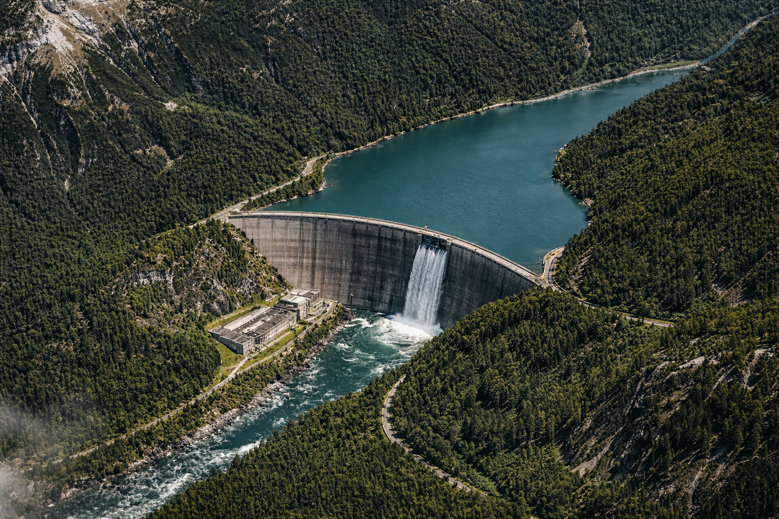
LIVE · InSAR STACK-12
2026-04-19 · 14:23 UTC47.23°N 8.45°E
Δ Ground displacement · 7d
+2.8 mm
NE vector · DAM-02 · Zurich, CH
Risk score
78 / 100
Elevated · Δ +6 from baseline
±2 mm
Ground displacement precision
6-day
Satellite revisit cycle
>98%
Anomaly detection accuracy
Global
Critical infrastructure coverage
SAR-12 · DAM-02 · ELEVATED · +2.8 mm · Zurich, CHInSAR-6 · BRIDGE-07 · STABLE · +0.2 mm · Lyon, FRSAR-08 · PIPE-14 · CRITICAL · +5.1 mm · Rotterdam, NLInSAR-3 · MINE-03 · ELEVATED · +3.4 mm · Johannesburg, ZASAR-15 · DAM-09 · STABLE · +0.1 mm · Nairobi, KEInSAR-7 · BRIDGE-22 · ELEVATED · +1.9 mm · Mumbai, INSAR-04 · PIPE-08 · STABLE · +0.3 mm · Calgary, CAInSAR-9 · MINE-11 · CRITICAL · +6.2 mm · Santiago, CLSAR-02 · ROAD-05 · STABLE · +0.4 mm · Berlin, DEInSAR-5 · DAM-17 · ELEVATED · +2.1 mm · Chennai, INSAR-12 · DAM-02 · ELEVATED · +2.8 mm · Zurich, CHInSAR-6 · BRIDGE-07 · STABLE · +0.2 mm · Lyon, FRSAR-08 · PIPE-14 · CRITICAL · +5.1 mm · Rotterdam, NLInSAR-3 · MINE-03 · ELEVATED · +3.4 mm · Johannesburg, ZASAR-15 · DAM-09 · STABLE · +0.1 mm · Nairobi, KEInSAR-7 · BRIDGE-22 · ELEVATED · +1.9 mm · Mumbai, INSAR-04 · PIPE-08 · STABLE · +0.3 mm · Calgary, CAInSAR-9 · MINE-11 · CRITICAL · +6.2 mm · Santiago, CLSAR-02 · ROAD-05 · STABLE · +0.4 mm · Berlin, DEInSAR-5 · DAM-17 · ELEVATED · +2.1 mm · Chennai, IN
How it works
From orbit to operational decision
01
Satellite capture
Radar and optical satellites pass over assets on 6-day cycles, generating displacement stacks across the full asset portfolio.
02
AI anomaly detection
Machine learning models identify deformation, moisture change and instability patterns invisible to periodic human inspection.
03
Risk intelligence output
Evidence-grade signals, risk scores and forensic packages delivered to insurers, operators and government risk teams.
Built for
Three types of risk teams
VIGIL-EARTH serves the full risk chain — underwriting, operations and government oversight.
Insurers & Underwriters
Continuous portfolio risk visibility for underwriting decisions and pre-event claims intelligence.
- Displacement history
- Risk score trends
- Forensic evidence package
Infrastructure Operators
Early warning intelligence for dams, bridges, pipelines and mine sites before physical failure.
- Real-time alert feed
- Asset health scores
- Inspection prioritization
Governments & Public Sector
National-scale infrastructure monitoring for disaster prevention and public safety mandates.
- Portfolio dashboard
- Policy-grade reporting
- Cross-agency data access
Use cases
Where VIGIL-EARTH is deployed
From agricultural land to urban cores — any asset where ground movement, water change or structural shift represents financial or physical risk.
Agriculture monitoring
AgricultureTrack soil subsidence, irrigation-induced settlement and crop field deformation to protect yields and inform agri-insurance underwriting.
Real estate & urban growth
Real EstateIdentify ground subsidence, foundation risk and land movement near development sites before construction begins or assets are acquired.
Dam & reservoir safety
InfrastructureContinuous surveillance of slopes, foundations and spillways for early structural warning — weeks before visible failure signs emerge.
Pipeline & energy corridors
EnergyDetect ground movement, erosion and third-party interference along critical energy infrastructure before leaks or failures occur.
Mining & industrial sites
MiningMonitor tailings pond integrity, pit slope stability and subsidence at active and legacy extraction sites with satellite precision.
Coastal & environmental
EnvironmentQuantify shoreline erosion, wetland loss and land reclamation dynamics using repeat-pass satellite observation across wide coastal zones.
Insurance underwriting
InsuranceReplace subjective risk opinion with satellite-derived displacement history and risk scores for property, casualty and specialty portfolios.
Ready to deploy
Monitor risk before failure becomes visible.
Partner with VIGIL-EARTH to turn satellite data into urgent, trusted intelligence for your most sensitive assets.